


Click here for more information RESULTS
______________________________________________________________________________
Hunter Valley Championships 2022
The 2022 Hunter Valley Championships will be held in conjunction with NOY 8 on 18 September 2022.
Available Championships classes are listed in the Age / Course / Class matrix below.
To be official in the Championships results you must enter a class that is an option in the row for your age group (this is the age you are turning in 2022).
You will also be official if you enter a class listed in the same column above your age class. (For example, W60A could instead enter W(50-59)AS or W(19-49)AS).
Open courses can be entered by any age group. AS classes are “Short” classes. AX are “Extra short” classes.
You can enter any course regardless of your age but you will not be official in the Championships results if the course is not an option for your age group.
All results for each course will also be counted in the 2022 Newcastle Orienteer of the Year pointscore.
Hunter Valley Championships - Age / Course / Class matrix
|
MEN |
|||||||
|
Age you turn in 2022 |
Very Easy |
Easy |
Moderate Short |
Moderate Long |
Hard Short |
Hard Medium |
Hard Long |
|
12 or under |
M12A |
M14A |
M18B |
MOpenB |
M18A, M19-49AX |
M19-49AS |
OpenA |
|
13 - 14 |
M14A |
M18B |
MOpenB |
M18A, M19-49AX |
M19-49AS |
OpenA |
|
|
15 - 18 |
M18B |
MOpenB |
M18A, M19-49AX |
M19-49AS |
OpenA |
||
|
19 - 39 |
MOpenB |
M19-49AX |
M19-49AS |
OpenA |
|||
|
40 - 49 |
MOpenB |
M19-49AX |
M19-49AS |
M40A, OpenA |
|||
|
50 - 59 |
MOpenB |
M50-59AS |
M50A |
M40A, OpenA |
|||
|
60 - 69 |
MOpenB |
M60A |
M50A |
M40A, OpenA |
|||
|
70 or over |
MOpenB |
M70A+ |
M50A |
M40A, OpenA |
|||
|
WOMEN |
|||||||
|
Age you turn in 2022 |
Very Easy |
Easy |
Moderate Short |
Moderate Long |
Hard Short |
Hard Medium |
Hard Long |
|
12 or under |
W12A |
W14A |
W18B |
WOpenB |
W18A, W19-49AS |
WOpenA |
OpenA |
|
13 - 14 |
W14A |
W18B |
WOpenB |
W18A, W19-49AS |
WOpenA |
OpenA |
|
|
15 - 18 |
W18B |
WOpenB |
W18A, W19-49AS |
WOpenA |
OpenA |
||
|
19 - 39 |
WOpenB |
W19-49AS |
WOpenA |
OpenA |
|||
|
40 - 49 |
WOpenB |
W19-49AS |
W40A, WOpenA |
OpenA |
|||
|
50 - 59 |
WOpenB |
W50-59AS |
W50A, WOpenA |
OpenA |
|||
|
60 - 69 |
WOpenB |
W60A |
W50A, WOpenA |
OpenA |
|||
|
70 or over |
WOpenB |
W70A+ |
W50A, WOpenA |
OpenA |
Newcastle Orienteer of the Year Event # 8 & Hunter Valley Championships - Stockrington West
Date: Sunday 18 September 2022
Start times: 9:30 am to 11:30 am Course Closure: 1:00 pm
Map: “Stockrington West”. Scale 1:10 000. 5m contour interval. Ian Dempsey 2019.
Course planner: Glenn Burgess.
Directions:
NOTE - The road into the assembly area (Haul Rd) is a closed road that has been opened for the event. It is sealed but narrow in parts and has some potholes and lots of debris. Drive slowly with care. After passing under the expressway and climbing the big hill observe a 30kmh speed limit and BE ALERT FOR RUNNERS ON THE ROAD. All courses cross the road and competitors may choose to run along it. Give way to competitors.
From the East & South - From Seahampton travel northwest on George Booth Drive. After around 5km turn right through a gate into Stockrington SCA. (This turnoff is at the bottom of a hill, 1.3km after the “Welcome to Cessnock” monument). Follow the sealed road carefully for 3.7km to the assembly area.
From the West - Travel south and east on George Booth Drive. About 1km past the Orica turnoff (Echidna Drive) turn left through a gate into Stockrington SCA. Follow the sealed road carefully for 3.7km to the assembly area.
Parking: Drive slowly past the assembly area and park on the side of the sealed road. Use parking space efficiently.
Assembly / Start: The assembly area is adjacent to the road. The start is 30m from the assembly area on the opposite side of the road. After punching the start unit follow the track 30m to the Start Triangle.
COURSE & MAP NOTES (See separate info for Hunter Valley Championships classes - click here)
COURSE LENGTH CLIMB (approx.)
Very Easy 1.4 km 35 m Follows tracks, a watercourse and streamered routes.
Easy 2.1 km 55 m Controls near tracks and watercourses. Some options to cut across.
Moderate Short 2.4 km 70 m Moderate cross country navigation.
Moderate Long 3.5 km 100 m Moderate cross country navigation.
Hard Short 3.4 km 95 m More difficult navigation.
Hard Medium 5.4 km 195 m More difficult navigation.
Hard Long 6.9 km 225 m More difficult navigation.
- All courses cross the sealed road. Orienteering traffic should be the only road users but there may be illegal trial bikes and vehicles on the road or on other trails. Beware of traffic when crossing or running on the road.
- The Very Easy and Easy courses follow taped routes between some controls (not shown on the other courses).
- The Easy and all Moderate and Hard courses cross old fencelines. Beware of wire or cable on the ground which may be a trip hazard.
Terrain: Gently undulating to steep spur/gully eucalypt forest with minor rock detail. Open forest with mostly good running on the ridges and upper slopes. Thicker vegetation in the major gullies. Tree root mounds and thicket detail throughout the map. An old sealed road (closed to public traffic) traverses the western part of the map. Fire trails along the major ridgelines are linked by several trail-bike tracks. Steeper slopes border the area.
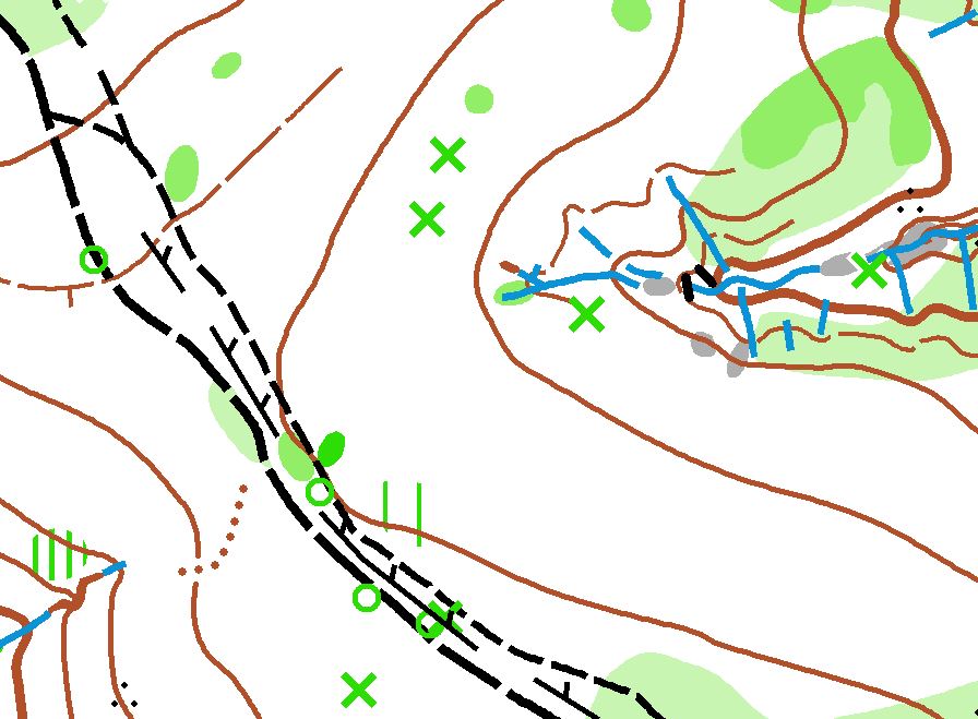
Special map symbols:
Green cross = tree root mound >1.5m
Small green circle = Native Cherry tree(s)
Black circle = man-made feature (eg. metal post, rubbish)
Note - There is extensive tyre debris from illegal burn out activity and other rubbish adjacent to the sealed road, particularly just south of the assembly area. This is not shown on the map.
Control descriptions will be printed on the map and are also available here - WORDS or SYMBOLS.
No water will be provided at the assembly area or on the courses. Please bring/carry your own.
Out of bounds / Warm up area: All forest east of the road and south of the assembly area is out of bounds. Competitors can warm up on the sealed road to the northwest of the assembly/parking.
Safety: The Safety Bearing is WEST to the sealed road, or EAST to the sealed road if you have crossed the road. Beware of traffic when crossing or running on the road.
Help with collecting controls following the event closure will be needed and very much appreciated.
Date: Sunday 17th July 2022
Starts: 9:30-11:30 am Course Closure 1 pm
Map: Redgum Ridges 1:10 000
Assembly: 150m inside and east of the main gate. GPS: -32.98862, 151.50169
PLEASE CAR POOL DUE TO LIMITED PARKING (see important information below)
Directions
From M1 take the Toronto Exit (Palmers Rd) then head west twowards Freeman’s Waterhole. From Cessnock travel to Freemans Waterhole and turn left at the roundabout heading towards Toronto. The event is on the sounthern side 1.5km along Palmer’s Rd.
Give plently of indication when turning. It is a 90km per hour road.
Parking: Due to recent wet weather, there will be limited parking at the assembly and in the areas previously used west of the main gate. (15-20 cars). Some off road parking is located 1km west of the freeway junction (150m after the private road, and immediately after you cross the concrete bridge on the road). Turn left into a small parking area which may hold approximately 20-40 cars depending on weather. It is a 500m walk west to the assembly. Once full, vehicles will need to park on the southern side of the main road (Palmers Rd) well before, and well after the main gate. Park as far off the edge of the main road as possible and take extra care when opening doors. Please keep away from the main gate entrance as our landholders have requested access.
Another possiblity is to park at Freemans Waterhole, 1.5 kms west, and use it as your warm up and cool down run, or arrange to car pool from the Lake Maquarie Memorial Park at Ryhope (just east of the Freeway junction) where there is plenty of parking. Thank you for your help.

Courses: The start for all courses will be 50m east of the registration.
Hard Long - 6.4km, 200m climb, 19 controls (includes a spectator control before a final hill loop)
Hard Medium - 4.9km, 160m climb, 16 controls
Hard Short - 3.5km, 115m climb, 12 controls
Moderate Long - 4.0km, 85m climb, 15 controls
Moderate Short - 2.5km, 65m climb, 11 controls
Easy - 2.5km. 60m climb, 10 controls
Very Easy - 2.1km, 55m climb, 11 controls
Control Descriptions are printed on the maps. If you'd like to have an additional copy - download them here - words or symbols
Notes
- The Redgum Ridges map features intricate detail in watercourses and lower slopes, separated by steep ridges. Tracks are mostly restricted to the ridge lines. The bush is mostly open and very runnable in most parts.
- Some watercourses are deeply eroded with steep to vertical sides. These can be difficult to cross and be slippery.
- Derelict barbed wire fences parallel many of the tracks - some are marked with red tape.
- If heavy rain precedes the event some creeks may be difficult to cross.
- Leg protection is recommended.
- Some leeches have been found during setting and vetting.
- Trail bikes are active and there is an acess road through the course to a neighbours house (south from the main gate ) that most runners will cross or use during their course. Keep out of their way.
- Tree root mound symbol has been removed from this map. X = wreckage; O = survey post
- One streamer trail is shown on the relevant maps with pink/ purple dashes.
- No toilets at the event. Nearest at Freemans Waterhole.
Saftey Bearing: North to the main track
Acknowledgements: Thanks to State Forests and adjacent landholders the Sheedy and Cleary families for allowing us access. Thanks to Jenny and Erika Enderby for vetting the course.
At least 3 helpers are needed for parking, and 5 helpers are needed to collect controls.
“Contours and Compass” Training
Description:
The area is on the outskirts of Newcastle and is characterised by an intricate track network, complex water features, a major powerline, and mixed runnability. Like many areas, there are some features that are more liable to change over time (e.g., tracks, car wrecks, vegetation) than others (e.g., contours, rocks, major water features). The purpose of this training event is to practise using the reliable features to help navigate around the course, even when utilising the tracks!
Courses:
Easy, 2.1 km – Controls are on or close to tracks. Practise checking direction with your compass, and the shape of the land using the contours, rather than just relying on the tracks themselves.
Moderate, 3.4 km – Longer legs and harder control sites than Easy. Structure each leg carefully and make sure you have a clear attack point.
Hard Short, 3.6 km – Full difficulty and some low visibility areas. To sharpen focus on navigating by more reliable features (and compass), tracks have been removed from the map. Power pylons are also gone. A blank complete map is on the flip side, however, as a backup.
Hard Long, 5.8 km – Like Hard Short but with a map flip halfway and no blank complete map as backup. Some controls are in the greener areas in the north not visited by the other courses.
Each control is marked by a flag and an electronic (SportIdent) punching unit.
Control Descriptions:
WORDS or SYMBOLS
The start for all courses is 200 m from the assembly area. Follow the blue and white streamers.
Starts are from 9.30 – 11.30 am. Course closure at 1 pm.
Directions:
Head to Killingworth. In Killingworth turn north onto The Boulevarde that becomes Killingworth Rd. After about 1 km park carefully along the side of the road near the Transgrid substation. Note that there are numerous potholes on Killingworth Rd – drive slowly!
Safety:
The area is frequented by motorbikes and 4WDs. Give them a wide berth!
Safety bearing is south-east to Killingworth Rd and then back to the assembly area near the substation.
Planner:
Stephen Craig, 0447 166 281