Summary
Roads, Streets, etc.
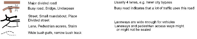
Note: The road and street symbols represent the road and its associated verge/footpaths
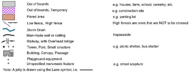
Other Man Made Features
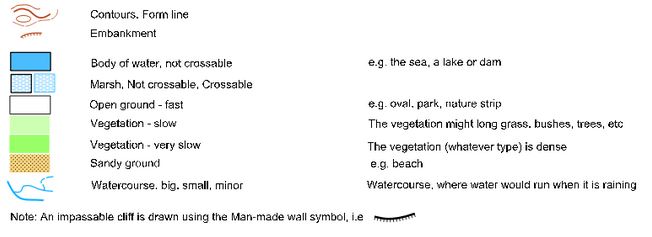
Natural Features
Highlight Features

A More Detailed Discussion
“Open ground” is any natural surface over which the competitor can run confidently. Typical examples would be ovals, parks and nature strips.
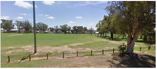
The oval in this photo has been mapped as white on the relevant Street-O map. Even though there are trees around the two “small structures” (in this case picnic tables) on the map it is still marked as “Open Ground - fast” since these trees won’t really hinder your running speed.
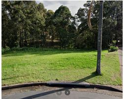
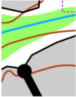
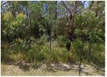
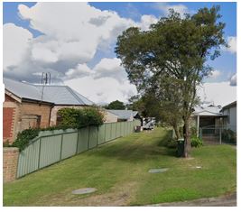
The bushland area between residential areas shown in this photo has been mapped as “Vegetation - slow” on the relevant Street-O map. The mapper feels that the competitor would not be able to run unimpeded through this area.
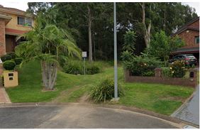
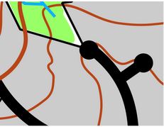
The vegetation in the area between the houses shown in this photo is such that the mapper feels that the competitor would have to slow to a walk and “push" their way through. Thus this area has been mapped as “Vegetation - very slow”.
An “Out of Bounds” area on a Street-O map indicates that the competitor is NOT allowed to enter this area. It is used for all residential areas but is also used for open areas that the public are NOT to enter, e.g. private paddocks, cemeteries, golf courses etc.
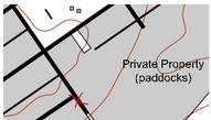
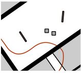
For example, at the red X on the Street-O map, on one side the Out of Bounds area are all private residences but on the other side the Out Of Bounds area is a private paddock. In either case, competitors are NOT allowed to enter these areas.
Sometimes it might be tempting to ignore the Out Of Bounds indication on the map and to enter/or cross such areas. Obviously, this is not in the spirit of the event but more importantly we want to be “good” citizens and not be a nuisance in the suburbs that we use. So, DON’T DO IT! And remember, with MapRun we can check the routes of the entire field in one quick-to-run animation where it will be obvious if anyone is cheating.
5. Laneways and Pedestrian Access Ways
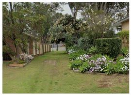
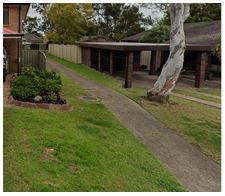
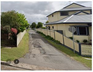
The laneway symbol is used to represent access ways that are (potentially) used by vehicles but are not wide enough to be classified as a street. In most cases they are sealed, as shown in the photo on the left. However the access way shown in the photo on the right has also been mapped as a laneway.
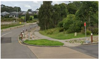
Access ways that are suitable only for pedestrians (or push bikes etc.) are mapped using the Pedestrian Access symbol. Again, these access ways may be sealed, (e.g. concrete footpath, a cycleway etc.) but could be just a grass passageway or similar. All of the access ways shown in photos below have been mapped as pedestrian access ways.